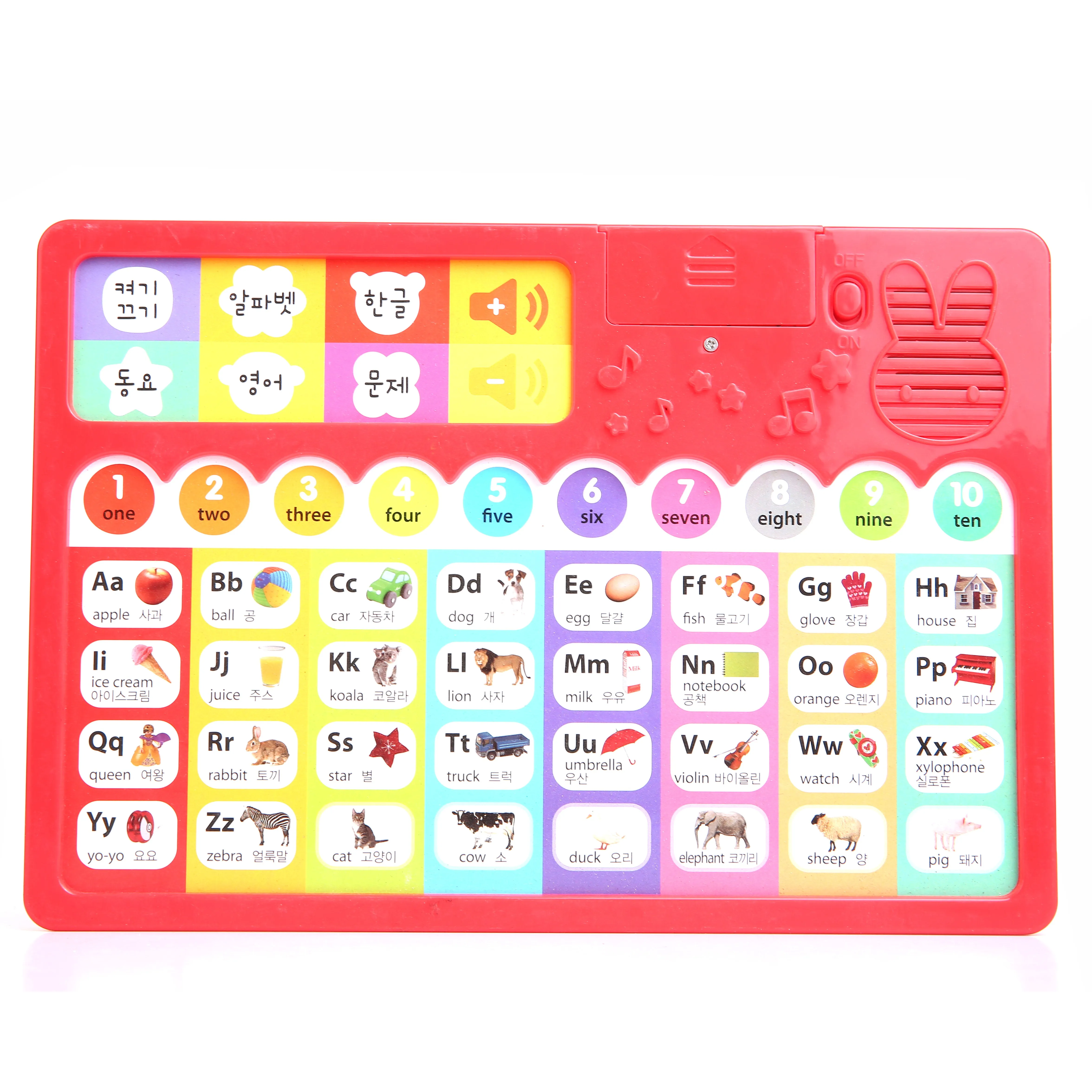
Our Geographical Knowledge Learning Pen serves as a comprehensive digital atlas, transforming traditional maps and globes into interactive, talking learning experiences. This device is engineered to spark curiosity about the world, its diverse cultures, physical landscapes, and geopolitical structures. By simply tapping the pen on a specific country, ocean, mountain range, or city featured on a specialized map, children are greeted with a wealth of age-appropriate information. This can include the location's name, capital city, official language, unique wildlife, famous landmarks, traditional foods, and fun facts. The primary application is in both formal and informal educational settings. At home, it fosters family learning time, exploring different continents together. In schools, it becomes an invaluable resource for geography, social studies, and cultural awareness classes, making lessons dynamic and memorable. For example, a teacher covering a unit on South America can have students use the pen to discover the Amazon Rainforest's biodiversity, hear the name "Andes Mountains" pronounced correctly, and learn about the ancient Inca civilization. The content is meticulously curated to be accurate, engaging, and free from cultural bias. Advanced versions may include quizzes and challenges, such as asking the user to find a country based on a clue, thereby testing and reinforcing their knowledge. The hardware is built to last, with a robust casing developed from our custom molds to withstand frequent use. The high-definition speaker ensures clear narration, which is crucial for pronouncing foreign names correctly. We take pride in our ODM expertise, allowing us to customize the pre-loaded geographical content to specific regional curricula or client preferences. To inquire about available map sets, customization options, and pricing, we encourage you to get in touch with us for more information.
08
Aug
23
Jul
23
Jul